Geocoding Gone Wild…

I came across this article that shows what can happen when you don’t get it all right. To quote…

The Los Angeles Police Department is battling a virtual crime wave in downtown L.A. caused by an Internet map coding error.

If the department’s online crime map is to be believed, one might thing that a downtown location just a block from the LAPD’s new headquarters is the most crime-ridden place in the city. In the past six months, that location experienced 1,380 crimes–4 percent of all crimes mapped–or roughly eight a day.

The crimes were real, but a coding error with the system’s geocoding–the process of converting addresses into map points–caused the crimes to be represented at a default location, according to a report Sunday in the Los Angeles Times. The mistake caused many crimes to be mapped miles away from their actual locations, causing false trends to be reported while masking real ones, according to the report.

You can read the full story here

Happy New Year to the Southern Ontario Elephant

Happy New Year to all!

Came across this post on the very excellent Strange Maps blog. Since I find myself residing  in the pits of the front legs, I thought this would be an appropriate way to start off 2009. At least I don’t live in Owen Sound. To quote:

Elephants are native to Africa and India and… Canada? Well, not really, but if you tilt your average north-oriented map of Ontario 90 degrees to the right, the province’s southern peninsula will show a more than passing resemblance to an elephant, tooting its trunk.

The full article can be found here.

Canadian Election Maps 2008

There are a couple of sites with maps of the 40th Canadian Federal Election, but not many that are really innovative. The best is probably the CBC’s map because you can see the riding boundaries and party colours, and zoom in with interactive results. The Globe and Mail’s map is pretty simple in comparison. My friend Tracey has written up a post over on datalibre.ca looking at several of the other contenders for displaying election results.

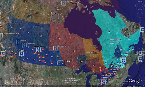
Google Earth Canadian Elections Map

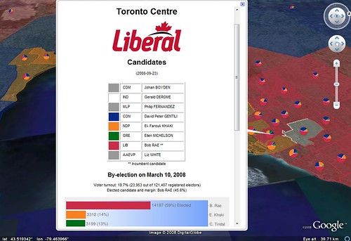
Cedric Sam has created a Google Earth map application of all Canadian ridings as they were represented when Parliament dissolved and shows a variety of information, such as election history by riding and some Pie charts represent vote shares at the last general election. You can read about the details of how he put together this application on his blog.

Google Earth / Élection fédérale 2008 au Canada / 2008 Federal Election in Canada

Elections Map

Zoom in

Datalibre.ca is back from the dead

After getting hacked and being offline for a couple of months, datalibre.ca is back in action!

A couple of months back, datalibre.ca got hacked, Google delisted us, and our host shut us down.

I finally got around to doing a reinstall of wordpress, and replacing all the infected php file. Some twiddling left do do yet, but … we’re up and running.

Sorry for the glitch in service.  So we’re back to agitating for data freedom in Canada, to whit:

datalibre.ca is a group blog, inspired by civicaccess.ca, which believes all levels of Canadian governments should make civic information and data accessible at no cost in open formats to their citizens. The data is collected using Canadian tax-payer funds, and we believe use of the data should not be restricted to those who can afford the exorbitant fees.